Iconic Andean Trails: The Best Hikes for Scenic Exploration
The Iconic Andean Trails – the world’s longest mountain range – stretch like a living spine down South America. The high ridges and deep valleys shaped ancient civilisations and continue to inspire travellers today.
Peru sits at the heart of this chain, and its mountains are home to some of the planet’s most spectacular hiking routes: from the famous Inca Trail to Machu Picchu to lesser‑known circuits through remote valleys where snow‑capped peaks tower above emerald lakes.
For luxury adventure travellers, these routes offer more than just physical challenge; they provide an intimate connection with Andean cultures, wildlife and history. As a premium and ethical tour operator, Alpaca Expeditions specialises in curating extraordinary trekking experiences that respect local communities and the fragile mountain environment. This comprehensive guide goes beyond a simple “top hikes” list.
It explores the history, ecology and cultural context of each iconic trail, offers practical tips for altitude acclimatisation and permits, and emphasises responsible tourism throughout.
Whether you dream of hiking beneath glaciers on the Ausangate Circuit or tracing Inca footpaths along the Qhapaq Ñan, this long‑form blog will help you plan a trip that honours both the landscape and those who call it home.
Why the Andes Captivate Adventure Travellers
The Andes stretch over 8,000 km (4,970 mi) along South America’s western flank, with towering volcanoes, deep canyons and high‑altitude plateaus. Peru’s segment of this range is particularly diverse.
In the north, the Cordillera Blanca and Huayhuash are home to glaciers and crystalline lakes; in the centre, lush cloud forest cloaks ancient ruins; and in the south, colourful sedimentary layers paint mountains like rainbows.

Beyond their natural beauty, these mountains hold millennia of cultural heritage. The Inca Empire unified highland societies with a sophisticated road system known as Qhapaq Ñan. According to UNESCO, the Qhapaq Ñan comprised over 23,000 km of roads connecting production, administrative and ceremonial centres across harsh Andean topography.
Along these routes, messages, food and armies moved quickly; today, sections of the Qhapaq Ñan form the backbone of some of Peru’s most iconic hiking trails.
Trekking in the Andes is physically challenging due to steep gradients and high altitude. Many trails exceed 4,000 m (13,123 ft), and some passes climb above 5,000 m (16,404 ft). It is essential to acclimatise and ascend gradually.
The UK’s National Health Service notes that altitude sickness can occur above 2,500 m; they advise spending a few days below this level, ascending slowly and resting every 3–4 days at the same elevation. Their guidelines recommend drinking plenty of water, avoiding alcohol and not sleeping more than 500 m higher than the previous night.
Ethical and sustainable trekking is equally important. Limiting group sizes, using professional guides, hiring local porters at fair wages and respecting trail regulations help protect fragile ecosystems and support local livelihoods.
Alpaca Expeditions works with community‑run campsites and emphasises Leave No Trace principles. Throughout this guide, you’ll find suggestions on how travellers can minimise their impact while enjoying world‑class hiking.
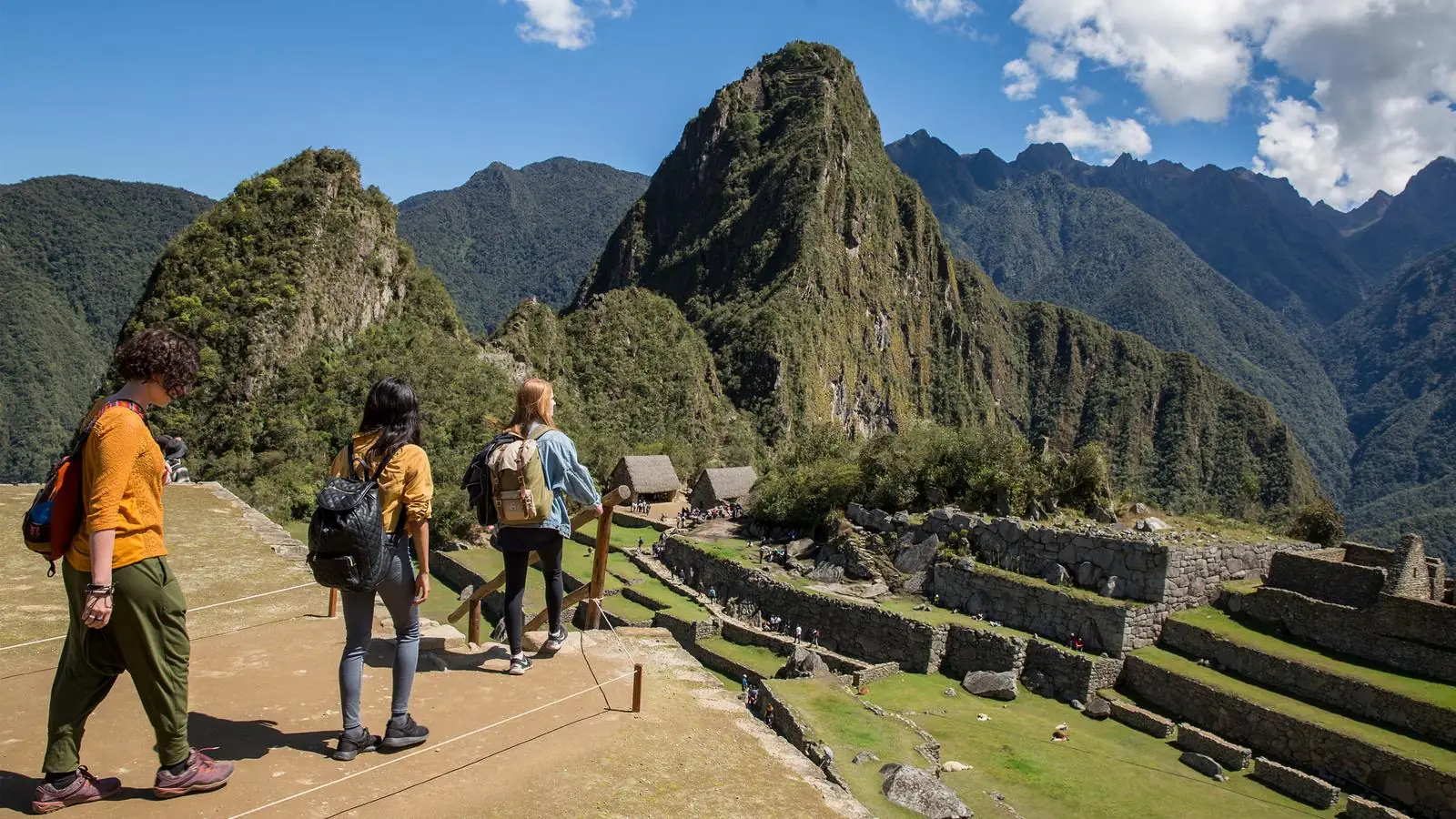
The Classic Inca Trail to Machu Picchu
Overview and Significance
The Inca Trail (Camino Inca) is arguably the most famous trek in South America. This 42 km (26 mi) route threads through cloud forest and alpine tundra, culminating at Machu Picchu’s Sun Gate. It follows a section of the Inca road network and passes multiple archaeological sites.
The trail’s elevation gain is around 2,500 m, with the highest point at Warmi Wañusqa (Dead Woman’s Pass) at 4,215 m (13,829 ft). The lowest point is Machu Picchu at 2,430 m (7,970 ft).
Three overlapping routes exist: the Mollepata (longest), Classic, and One Day trails, each passing Inca ruins and biodiversity zones from cloud forest to high puna. The longer routes ascend above 4,200 m and can cause altitude sickness.
To prevent erosion, the Peruvian government restricts the daily number of hikers; only 500 people (200 trekkers plus guides and porters) are permitted, and advance permits sell out months in advance.
The classic trek typically takes four to five days. Starting at Km 82 or Km 88 on the Urubamba River, hikers climb gradually, camp at Llulluch’apampa, cross Dead Woman’s Pass, descend to the Pakaymayu valley and eventually reach the Sun Gate (Inti Punku) for the iconic first view of Machu Picchu.
Highlights
- Patallaqta & Wayllapampa ruins: Early on, hikers pass through Patallaqta, a terraced agricultural settlement, and climb to the hamlet of Wayllapampa amid lush vegetation and orchids.
- Dead Woman’s Pass: The high point of the trail; reaching this windy saddle at 4,215 m rewards trekkers with panoramic views of snow‑capped peaks.
- Runkuraqay, Sayaqmarka & Phuyupatamarka: Later on, the trail leads past semi‑circular watchtowers and finely carved walls. Phuyupatamarka, dubbed the “Town in the Clouds,” sits above swirling mist and offers vistas across the Urubamba valley.
- Inti Punku (Sun Gate): The final climb reveals Machu Picchu for the first time. Arriving at dawn is especially moving as the rising sun illuminates the ancient citadel.
Logistics & Practical Tips
Permits and guides: Permits usually go on sale in October for the following year and sell out quickly. Hiring a licensed guide is essential; and while many local companies rely on travel link building services to promote their services online, reputable operators like Alpaca Expeditions ensure ethical porter treatment and small group sizes.
Acclimatisation: Spend at least two or three days in Cusco (3,399 m) to acclimatise. Short acclimatisation hikes near Cusco (Sacsayhuamán, Rainbow Mountain or the Sacred Valley) help prepare your body.
Best season: The dry season (May–September) offers clear skies and crisp nights. The trail is closed in February for maintenance.
Ethical travel: Choose operators that prioritise porters’ rights (e.g., proper weight limits, fair wages and access to gear), avoid littering, use eco‑friendly toiletries and respect archaeological sites.
The Salkantay Trek: An Untamed Alternative
Overview
The Salkantay Trek is often billed as the wild alternative to the Inca Trail. Named after Nevado Salkantay, a 6,271 m (20,574 ft) snow‑capped peak sacred to the Inca, this route offers varied scenery and less‑crowded trails. According to the Wikivoyage travel guide, the trek starts in Mollepata and typically crosses the Salkantay Pass at 4,600 m before descending into cloud forest en route to La Playa and Santa Teresa. The standard trek lasts about four to six days and can be extended to join the Inca Trail for a longer experience.
Highlights
- Salkantay Pass (4,600 m): The highest point of the trek reveals a dramatic contrast between the snow‑clad slopes of Salkantay and the green valleys below.
- Humantay Lake: A turquoise glacial lake nestled below towering peaks. Many trekkers visit on day 1.
- Cloud forest & coffee plantations: After the pass, the trail descends into warm cloud forest where orchids, bromeliads and hummingbirds thrive. Local villages like Collpapampa grow coffee and fruit.
- Santa Teresa & Aguas Calientes: Some variations finish with a soak in the hot springs at Santa Teresa, then continue to Aguas Calientes and Machu Picchu.
Practical Considerations
Difficulty: The trek is challenging due to the high pass and daily elevation changes. Wikivoyage emphasises the need for proper layering to handle cold nights at high altitude and hot afternoons.
Guides & gear: While independent hiking is possible, hiring a guide improves safety and provides local insight. Pack warm clothing, waterproof gear and water treatment tablets.
Permits: Unlike the Inca Trail, no permit quota exists, but trekkers still need to respect local communities and camp at designated sites.
Best season: Dry season (May–October) offers the clearest mountain views. During the rainy season, landslides may block trails.
Responsible travel: Choose operators that provide proper waste disposal and avoid single‑use plastics. Support community‑owned campsites and buy local coffee or handicrafts to contribute to regional economies.
The Ausangate Circuit: High‑Altitude Wilderness
Overview
For experienced trekkers seeking remote landscapes, the Ausangate Circuit delivers a high‑altitude odyssey around one of the most sacred mountains in Inca cosmology. Wikivoyage describes the trail as a 70 km loop beginning in Tinqui and ending in Pacchanta.
The route remains above treeline almost the entire time, with passes at Arapa (4,700 m) and Apacheta (4,800 m) and culminating at Palomani Pass (5,100 m). Trekking typically takes four to five days and requires full camping gear and pack animals because there are no villages between Tinqui and Pacchanta. The best months are May to September when weather is drier.
Highlights
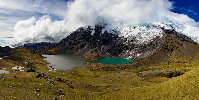
- Rainbow Lakes and Glaciers: The circuit skirts ice‑capped Ausangate (6,384 m) and passes colourful glacial lakes such as Laguna Pucacocha, where the turquoise water mirrors snow‑topped peaks.
- Hot springs: After days in alpine tundra, finishing at the hot springs of Pacchanta soothes tired muscles.
- Night skies: High altitude and minimal light pollution mean dazzling star displays.
- Cultural encounters: Quechua shepherds graze llamas and alpacas in the puna grasslands; respectful interactions give trekkers insight into contemporary Andean pastoral life.
Practical Considerations
Fitness and acclimatisation: Because the trail stays above 4,000 m and includes steep passes, only experienced hikers with high‑altitude acclimatisation should attempt the circuit. Nights can drop to –10 °C (14 °F), so proper equipment is essential.
Guides and pack animals: Hiring a local muleteer (arriero) to carry gear allows trekkers to focus on walking and ensures that local families benefit directly from tourism.
Environmental care: Pack out all waste, avoid disturbing wildlife and stay on established trails. The remoteness means rescue options are limited; carry a satellite communicator for emergencies.
Suggested image: Alpacas grazing under Ausangate’s snow‑clad summit. Caption: “Llamas and alpacas are constant companions on the high Ausangate circuit.”
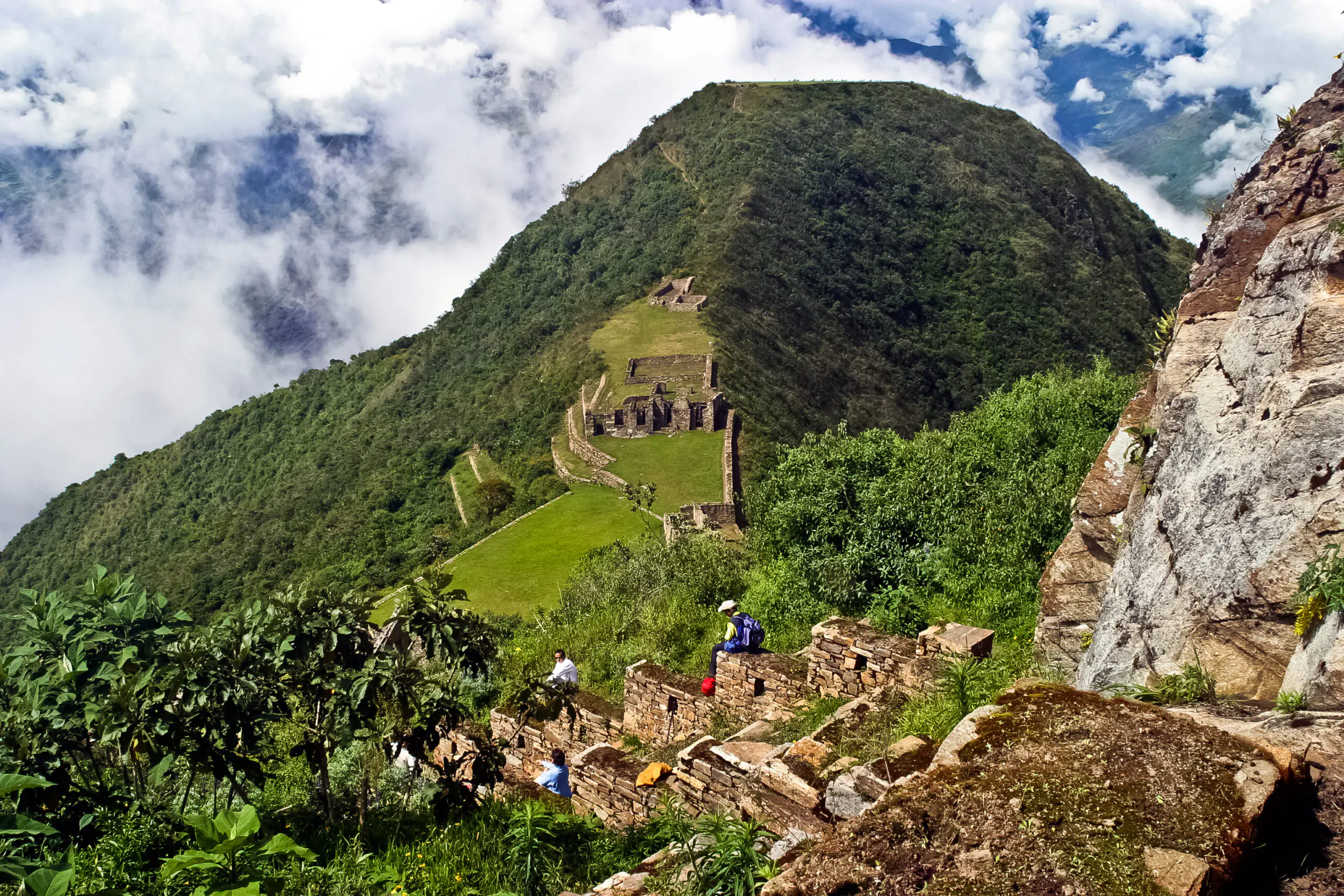
Choquequirao: Lost City Trek
Overview
Hidden high above the Apurímac River, Choquequirao is often dubbed the “sister city” of Machu Picchu. Archaeologists believe this complex served as a royal estate and ceremonial centre late in Inca history. Unlike Machu Picchu, Choquequirao is accessible only by foot, making it an ideal trek for travellers seeking solitude and archaeology.
Wikipedia notes that the main trail from San Pedro de Cachora to Choquequirao is about 20 km one way, while a shorter but steeper trail from Huanipaca is about 15 km. According to the same source, only around 5,000 trekkers visited in 2013. Many hikers combine Choquequirao with a continuation to Machu Picchu, crossing the Yanama Pass at 4,668 m, for a 7‑ to 11‑day expedition.
Highlights
- Apurímac Canyon: On the first day, trekkers descend about 1,500 m to the river, experiencing dramatic elevation change.
- Steep climb to Choquequirao: Day 2 includes an ascent of roughly 1,800 m to reach the ruins. The trail passes through cactus desert and cloud forest.
- Terraced ruins and llama carvings: The site itself features ceremonial plazas, terraces decorated with stone llamas, and temples facing snow‑clad peaks.
- Extension to Machu Picchu: For the ambitious, continuing over Yanama Pass yields additional Inca sites and remote valleys..
Practical Considerations
Difficulty: This trek is demanding due to steep descents and ascents. Hiring mules to carry gear eases strain.
Logistics: Guided tours depart Cusco. There are basic campsites and water sources en route.
Sustainability: The remote valley is home to small farming communities. Purchasing meals or camping in locally run sites helps support them. Respecting agricultural land and using existing trails protects fragile slopes.
Santa Cruz Trek: Cordillera Blanca Classic
Overview
North of Lima lies the Cordillera Blanca, a region of snow‑capped peaks and turquoise lakes. The Santa Cruz Trek is its flagship route: a 50 km (31 mi) trail through Huascarán National Park. Wikivoyage describes the trek as climbing to Punta Unión Pass at 4,750 m (15,580 ft) and taking three to four days. The route can be hiked in either direction—starting from Vaquería (3,700 m) or Cashapampa (2,900 m)—with varying logistics.
Highlights
- Alpine lakes: Lakes such as Laguna Jatuncocha and Laguna Arhuaycocha feature crystal‑clear water reflecting peaks like Taulliraju and Alpamayo.
- Punta Unión Pass: This high point affords 360° views of the Cordillera Blanca, including Peru’s highest mountain, Huascarán (6,768 m).
- Queñual forests: Sections of the trek pass through Polylepis (queñual) forests—gnarled trees adapted to high altitude.
Practical Considerations
Permits: Entry into Huascarán National Park requires a permit available in Huaraz. Visitors must camp at designated sites to prevent erosion and protect vegetation.
Difficulty: Although less strenuous than the Ausangate or Huayhuash circuits, Santa Cruz remains a high‑altitude trek. Gradual acclimatisation and carrying layers for cold nights are essential.
Guided or independent: Many hikers hire donkey drivers for gear transport; however, independent hikers can complete the route with lightweight equipment.
Best season: The dry season (May–September) ensures stable weather and clear mountain views.
Cordillera Huayhuash Circuit: Remote High Peaks
Overview
The Cordillera Huayhuash is a compact but spectacular range south of the Cordillera Blanca. The Huayhuash Circuit is considered one of the world’s finest alpine treks. According to Wikipedia, the circuit is about 130 km long, takes 10–14 days and involves passes between 4,600 m and 5,000 m. Most campsites lie above 4,000 m, and hikers traverse remote valleys dotted with glacial lakes.
Highlights
- Siula Grande & Yerupajá: These peaks, over 6,300 m, dominate the skyline. Siula Grande famously features in Joe Simpson’s mountaineering survival story, Touching the Void.
- Glacial lakes: Turquoise lakes such as Carhuacocha and Gangrajanca mirror the sharp peaks; at dawn, alpenglow paints the mountains pink.
- Wildlife: The remote valleys are habitat for Andean condors, vicuñas, and a variety of waterfowl.
Practical Considerations
Logistics: The circuit is remote. Most trekkers organise transport from Huaraz to villages like Llamac or Cuartelwain, which serve as trailheads. Local communities charge camping fees, and many provide donkeys.
Difficulty: High passes and multi‑day remote trekking demand strong fitness and prior high‑altitude trekking experience. Weather can be unpredictable.
Season: The dry season (May–September) offers the best conditions; snowstorms can occur at any time.
Responsible travel: Hikers should pack out all waste. Hiring local guides and donkey drivers ensures that economic benefits reach the isolated communities.
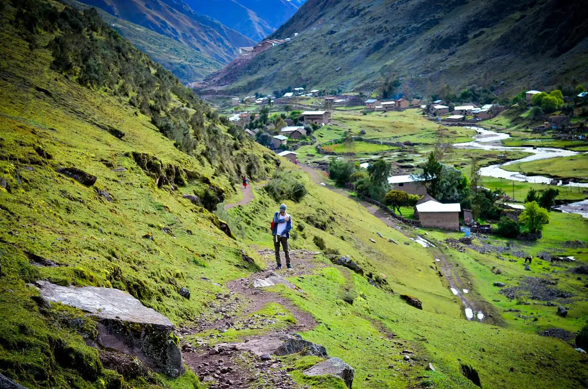
Lares Trek: Cultural Immersion
Overview
If you want a shorter trek with rich cultural encounters, the Lares Trek delivers. This 33 km (21 mi) high‑altitude hike near Cusco usually takes two to three days and doesn’t require a permit. According to Wikipedia, the trek starts near the village of Lares, ascends through weaving communities like Huacahuasi (3,750 m), crosses Ipsaycocha Pass (4,450 m) and descends to the Sacred Valley near Ollantaytambo. Multiple route variations exist; some begin or end in different villages, but all emphasise the cultural interactions along the way.
Highlights
- Weaving villages: Communities such as Patacancha and Huacahuasi are famed for traditional weaving techniques. Travellers can observe artisans spinning alpaca wool and dyeing textiles with natural plants.
- Hot springs: The Lares region is dotted with thermal baths; many trekkers soak in the Lares hot springs before or after hiking.
- Mountain passes: The trek includes high passes with views of snow‑capped peaks like Veronica and turquoise lakes.
Practical Considerations
Altitude: Though shorter than other treks, the Lares route crosses a 4,450‑m pass; adequate acclimatisation is still essential.
Guides: While independent trekking is possible, hiring a guide ensures navigation through multiple route options and facilitates meaningful interactions with local families.
Social responsibility: Many Lares communities rely on weaving for income. Buying textiles directly from artisans supports them. Respecting local customs, asking before taking photographs and learning a few Quechua phrases enrich the experience.
Rainbow Mountain (Vinicunca): A Kaleidoscope of Minerals
Overview
Vinicunca, commonly known as Rainbow Mountain, lies near Ausangate in the Cusco region. Standing at 5,036 m (16,522 ft), the mountain is striped with mineral deposits that create bands of red, gold, turquoise and lavender. The vivid colours emerged only after the snow and glacier cover melted around 2013, spurring a surge of visitors. Hikers can reach the viewpoint via a two‑hour drive from Cusco followed by a 5 km walk (or horseback ride) or through longer trails from Pitumarca.
Highlights
- Spectacular mineral colours: The slopes are layered with iron oxide (red), sulphur (yellow) and copper (green).
- Andean wildlife: Herds of alpacas and vicuñas graze on the surrounding puna grassland.
- 360° views: On clear days, the summit reveals views of Ausangate and the Vilcanota range.
Practical Considerations
Altitude: At over 5,000 m, Vinicunca is higher than many passes on multi‑day treks. Spend several days acclimatising in Cusco or the Sacred Valley before attempting the hike, and bring warm layers and sun protection.
Time of visit: Go early to avoid crowds; midday storms often bring clouds and hail. The dry season (May–October) offers the brightest colours and safest trail conditions.
Responsible tourism: Increased popularity has led to trail erosion. Stick to marked paths, avoid littering and consider visiting less‑popular alternatives like Palccoyo, which offers similar coloured hills but receives fewer visitors.
Laguna 69: Huascarán’s Sapphire Gem
Overview
Laguna 69 is a high‑altitude day hike located in the Cordillera Blanca. It begins at Cebollapampa (3,850 m) and climbs to 4,550 m at the lake. The hike is considered medium to difficult due to the final steep section and altitude; Bookmundi suggests at least a day of acclimatisation in Huaraz. The round‑trip distance is about 12 km (7.5 mi), and most travellers complete the excursion in one day, including a three‑hour drive each way from Huaraz.
Highlights
- Electric‑blue lake: Laguna 69 sits below the chiseled cliffs of Chacraraju; waterfalls tumble into the neon‑blue water.
- Alpine meadows: The lower trail meanders through pastureland dotted with wildflowers and gnarled queñual
- Accessibility: As a day hike, Laguna 69 is a great acclimatisation hike for longer treks in the Cordillera Blanca.
Practical Considerations
Permit: Laguna 69 lies within Huascarán National Park; you must pay an entrance fee and register at the checkpoint.
Timing: Start early to enjoy the lake before clouds build. During the wet season (January–March), heavy rain can make the trail slippery.
Altitude: Because the entire hike is above 3,000 m, travellers should be aware of altitude sickness; at least a day of acclimatisation is recommended.
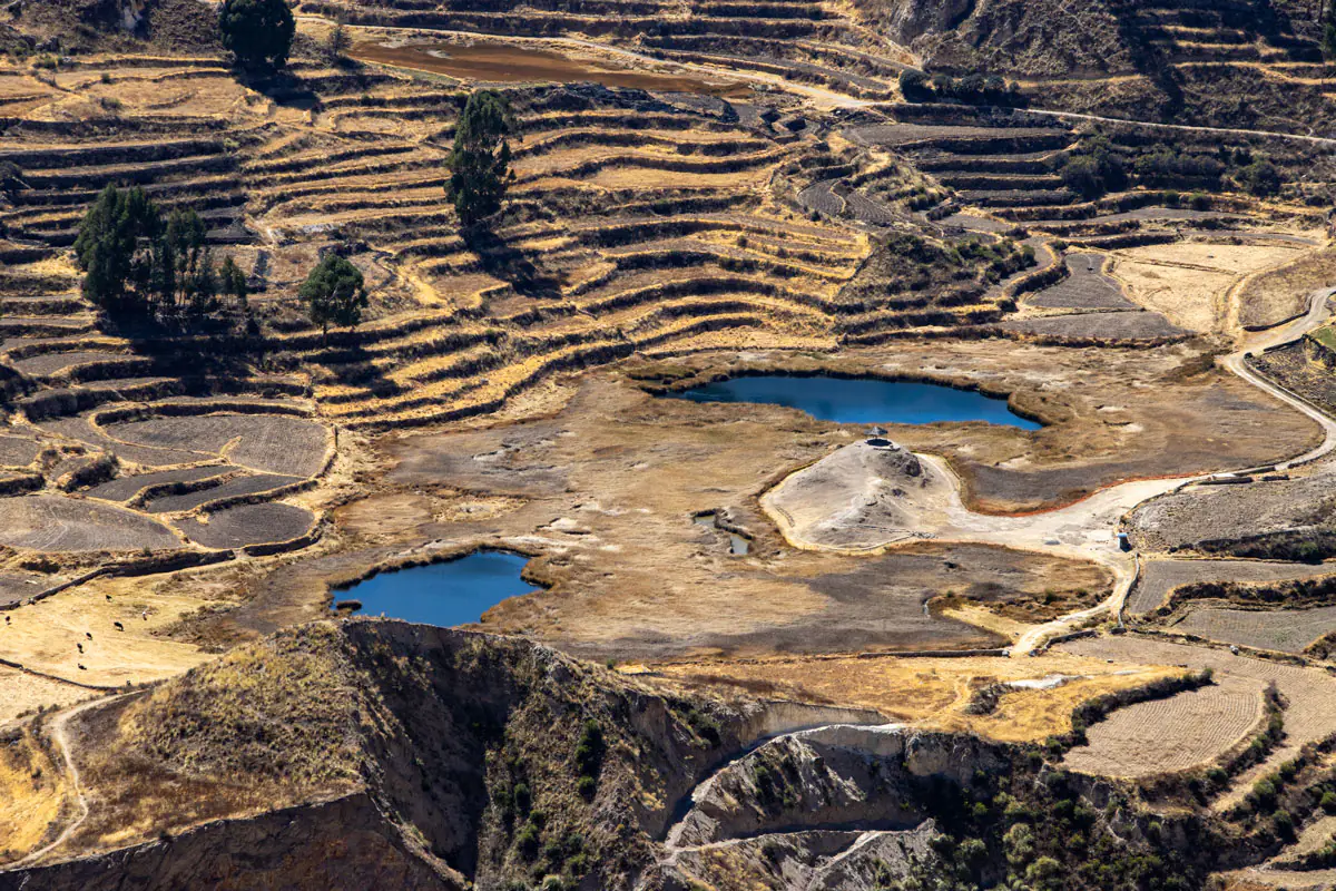
Colca Canyon: Descend into One of the World’s Deepest Canyons
Overview
South of Arequipa, the Colca Canyon slices deeply into the Andes. Wikipedia lists its depth as between 1,000 and 2,000 m (3,300–6,600 ft), with canyon edges at 3,000–4,000 m above sea level. The canyon is about 70 km (43 mi) long and is considered one of the deepest in the world. The region is home to the Collagua and Cabana people who continue to cultivate pre‑Inca terraces.
Highlights
- Cruz del Cóndor viewpoint: Early mornings, Andean condors ride thermal currents, soaring just meters from the viewpoint.
- Oasis of Sangalle: A lush valley at the canyon bottom with palm trees and swimming pools—a welcome respite after a long descent.
- Hot springs: Thermal baths near Chivay and Cabanaconde soothe tired muscles after the hike.
- Cultural encounters: Villages such as Chivay feature colonial churches and markets where locals wear traditional embroidered clothing.
Trekking Options
Standard treks are two or three days, descending from Cabanaconde to the canyon floor, overnighting in Sangalle and climbing back out. Longer options loop through remote villages.
Practical Considerations
Altitude: Trailheads are above 3,200 m; plan to acclimatise in Arequipa or the Colca valley.
Difficulty: Descents and ascents are steep, and daytime temperatures vary widely. Carry plenty of water and start early to avoid midday heat.
Responsible travel: Stay on established trails to prevent erosion; buy supplies from local vendors; avoid using drones without permission (condors can be disturbed).
Beyond Peru: Other Iconic Andean Trails Worth Mentioning
While Peru holds a treasure trove of routes, the Andean spine offers outstanding hikes in neighbouring countries too. Including a few highlights broadens the perspective for travellers planning multi‑country adventures.
Quilotoa Loop (Ecuador)
The Quilotoa Loop is a village‑to‑village trek through Ecuador’s central highlands, culminating at Laguna Quilotoa, a brilliant green crater lake. The loop typically takes 3–4 days and covers around 35 km with altitudes ranging between 2,700 m and 3,914 m.
Hikers stay in local guesthouses and pass through Andean farming communities. Though not part of our main route catalogue, the loop illustrates how Andean trails foster cultural immersion and support small‑scale tourism.
Torres del Paine W Trek (Chile)
In Patagonia’s Torres del Paine National Park, the W Trek is a 70–80 km trail that weaves among glaciers, turquoise lakes, and the iconic granite “Towers.” Typically completed in 4–6 days, the trek offers refugio lodging and camping.
Trekkers navigate valleys like the French Valley and end at the Base of the Towers, facing dramatic spires. Despite being beyond Peru, it’s included here to underline the Andes’ diversity—from arid northern canyons to southern glaciated landscapes.
Quilotoa & W Trek Responsible Travel Tips
- Support small, locally owned lodges.
- Use reusable water bottles and avoid single‑use plastics.
- Respect park rules and wildlife; maintain distance from animals like guanacos or condors.
- Research permit requirements; Torres del Paine, for example, requires pre‑booked campsites and limits visitor numbers.
Health & Safety Considerations for Andean Hikes
Altitude Acclimatisation
High altitude is a major challenge on Andean treks. The NHS advises that altitude sickness can occur above 2,500 m and recommends ascending slowly, spending a few days below this level before going higher, taking rest days every 3–4 days and staying hydrated. They also advise against ascending more than 500 m of sleeping elevation per night and avoiding alcohol.
Medication such as acetazolamide (Diamox) can aid acclimatisation, but consult your doctor before travelling. Recognise symptoms—headache, nausea, dizziness, insomnia—and descend if symptoms worsen. Trekking with an experienced guide like those from Alpaca Expeditions ensures proper emergency protocols.
Weather & Seasons
The Andean dry season (May–September) generally offers clear skies and stable weather. However, each region has nuances. For example, the Ausangate Circuit remains cold even in dry season with subzero nights.
Conversely, Rainbow Mountain may become snow‑covered in June. The wet season (October–April) brings lush landscapes but also slippery trails, landslides and flooded rivers. Check weather forecasts and talk to guides about seasonal considerations.
Permits & Regulations
Many Andean treks lie within national parks or protected areas. Inca Trail permits are strictly limited; Santa Cruz and Laguna 69 require park entrance tickets. Always register at checkpoints and follow park rules. Hiring certified guides ensures compliance.
Health & Vaccinations
Travellers should be up‑to‑date on routine vaccines and consider Hepatitis A and typhoid for Peru. Those heading into Amazonian areas beyond the Andean highlands may need malaria prophylaxis or yellow fever vaccines, but for the Andean treks described here, malaria risk is low due to altitude. Consult a travel clinic.
Packing Essentials
- Clothing layers: Temperatures swing widely. Include base layers, insulating fleece, waterproof jacket, gloves and hat.
- Footwear: Sturdy, waterproof hiking boots and camp shoes.
- Sleeping equipment: For multi‑day treks, a four‑season sleeping bag and insulated pad.
- Hydration system: Reusable water bottles or bladder; water purification tablets or filter.
- Sun protection: High UV exposure at altitude means sunglasses (category 4), sunscreen (SPF 50+) and lip balm.
- Trekking poles: Useful for steep descents and conserving energy.
- First aid kit: Include blister treatment, pain relievers, altitude medication and personal prescriptions.
- Reusable eating utensils: Help reduce plastic waste.
Responsible & Ethical Trekking in the Andes
Supporting Local Communities
Tourism can uplift or exploit; as travellers, we have a responsibility to contribute positively. Choose locally owned operators and community campsites. Hire local porters and muleteers; fair wages provide income for mountain communities. Buying handicrafts directly from artisans—like weavings from Lares or coffee from Salkantay villages—ensures profits remain in the region.
Environmental Stewardship
Fragile high‑altitude ecosystems take decades to recover. Stay on marked trails to prevent erosion. Carry out all waste, including organic matter. Avoid soaps and chemicals in waterways; use biodegradable products and wash dishes far from streams. If you smoke, pack out your cigarette butts.
Landslides and trail damage can occur if trekkers cut switchbacks. Resist the urge to create shortcuts, as they accelerate erosion. Use established campsites and avoid campfires above the treeline; alpine vegetation burns easily and grows slowly.
Respecting Cultural Heritage
Many trails traverse sacred sites. The Inca Trail passes temples, tombs, and terraces; Choquequirao and Machu Picchu were royal estates. Respect signage, do not remove artifacts or scratch stones, and stay behind roped‑off areas. Ask before photographing people and follow local customs, such as offering coca leaves when visiting a village elder.
Animal Welfare
On some treks, horses, mules, or llamas carry gear. Ensure the animals are well treated: loads should be appropriate for their size and not exceed weight limits. Choose operators that provide proper food, shelter, and veterinary care for pack animals.
Travel Insurance & Safety
Comprehensive travel insurance covering high‑altitude trekking, evacuation and medical expenses is non‑negotiable. Carry proof of coverage and emergency numbers. Use satellite communication devices in remote areas, and inform family or friends of your itinerary. Travel with reputable guides like Alpaca Expeditions, who are trained in high‑altitude first aid.
Planning Your Andean Adventure with Alpaca Expeditions
Alpaca Expeditions offers premium, tailor‑made trekking experiences across Peru. As an ethical operator, the company prioritises porter welfare, environmental stewardship and authentic cultural engagement. Here’s how Alpaca Expeditions distinguishes itself:
- Exclusive itineraries: From classic routes like the Inca Trail to bespoke expeditions across Ausangate or Huayhuash, Alpaca Expeditions customises trips to your fitness level, interests, and schedule.
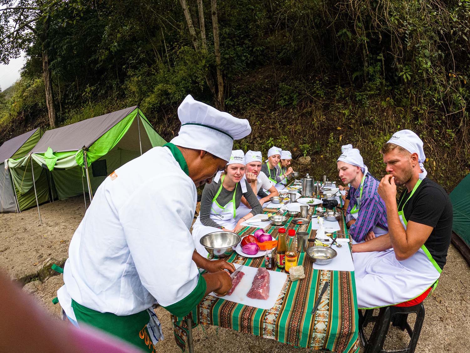
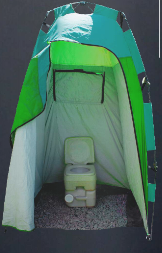
- Luxury touches: Enjoy comfortable camping with high‑quality tents, thick sleeping mats, and gourmet meals prepared by professional cooks. Portable toilets and dining tents enhance comfort without compromising sustainability.
- Skilled guides: Local guides share knowledge of Andean history, flora and fauna. Many speak Quechua as well as Spanish and English, enabling deeper interactions with village hosts.
- Porter welfare: The company implements fair porter weight limits, provides warm clothing and insurance, and invests in community projects.
- Sustainability: Alpaca Expeditions’ zero‑waste policy includes reusable lunch boxes, water refilling stations, and rubbish collection. The team collaborates with conservation projects and supports reforestation initiatives.
Booking with Alpaca Expeditions not only ensures a smooth and safe trekking experience but also empowers local communities and helps protect the fragile Andean environment.
Frequently Asked Questions (FAQ)
Do I need a permit for all Andean trails?
Permits are mandatory for the Inca Trail and are limited to 500 people per day. Santa Cruz and Laguna 69 require park entrance tickets. Salkantay, Ausangate, Huayhuash, Lares and Choquequirao currently do not have strict permit quotas, but hikers must pay community fees and register at checkpoints. Always book with licensed operators.
When is the best time to hike in the Andes?
The dry season (May–September) offers the best weather for most Peruvian treks. Southern Patagonia’s summer (December–February) is ideal for the W Trek. Shoulder seasons (April and October) can yield fewer crowds but unpredictable weather.
Avoid February for the Inca Trail—maintenance closes the route. highlights that Laguna 69 is most enjoyable during the dry season; rainy months make the trails slippery.
How fit do I need to be?
Moderate to excellent fitness is required. Even short treks like Laguna 69 involve steep ascents at altitude. Multi‑day circuits such as Ausangate and Huayhuash require strong cardiovascular conditioning and endurance. Training hikes at elevation or with weighted packs prepare your body.
Can I trek independently?
Some trails, like Laguna 69, Santa Cruz, and Lares, can be hiked independently by experienced backpackers. However, high‑altitude, remote routes like Ausangate and Huayhuash are safer with guides. The Inca Trail requires a licensed guide. Solo hikers risk getting lost, facing altitude sickness without support, or failing to find safe campsites.
Is altitude sickness guaranteed?
Not everyone experiences altitude sickness, but anyone can be affected regardless of fitness. Acclimatisation, slow ascents, hydration, and listening to your body reduce risk. If severe symptoms arise, descend immediately and seek medical assistance.
What should I pack?
Essential items include layered clothing, waterproof gear, sturdy boots, sleeping equipment, water purification, sun protection, trekking poles, and a comprehensive first aid kit. Hiring pack animals or porters through a reputable operator lightens your load. Use reusable containers to minimise waste.
Conclusion: Tracing Ancient Footsteps in Luxury and Respect
Exploring the Andes through its legendary trails is a transformative experience. Each route—whether the iconic Inca Trail or the wild Ausangate Circuit—reveals different facets of Peru’s natural beauty, history, and living cultures. Hikers witness the ingenuity of the Inca engineers who built roads across knife‑edge ridges and high passes.
They stand on windy summits overlooking glacier‑fed lakes, descend into canyons deeper than the Grand Canyon, and marvel at colourful mountains unveiled by climate change. And they encounter Quechua communities whose traditions have endured for centuries.
Yet great adventures come with responsibilities: to acclimatise safely, minimise environmental impact, and support the people who steward these landscapes. By choosing Alpaca Expeditions, travellers ensure that their Andean journey is both luxurious and ethical. With expert guides, comfortable camps, and a commitment to sustainability, you can immerse yourself in the Andean mountains knowing your visit helps preserve them.
From sunrise at Machu Picchu to condors soaring over Colca, the Andes invite you to lace up your boots and walk through history. As you plan your next epic hike, remember that the trail is not just a path—it’s a story written by glaciers and empires, farmers and porters. Step gently, tread respectfully and let the mountains change you.
Alpaca Expeditions Recognitions
ISO (International Organization for Standardization)
In the pursuit to stand out from the rest, Alpaca Expeditions has obtained four ISOs plus our carbon footprint certificate to date. These achievements result from our efforts to implement the internationally-recognized integrated management system. They also represent our commitment to all of our clients and staff of operating sustainability and responsibility in every way possible.


World Travel Awards
Alpaca Expeditions is internationally recognized as a leading tourism company in Peru. As proof, we have been awarded the World Travel Award for Peru´s Best Tour Operator 2021 for the second time.


TRIPADVISOR RECOGNITIONS
Our goal at Alpaca Expeditions is to create the best experience for all of our clients. We create journeys that are to be remembered for a lifetime. Journeys you can be proud of and can share with everybody around you.


As Featured In


Scan Here!


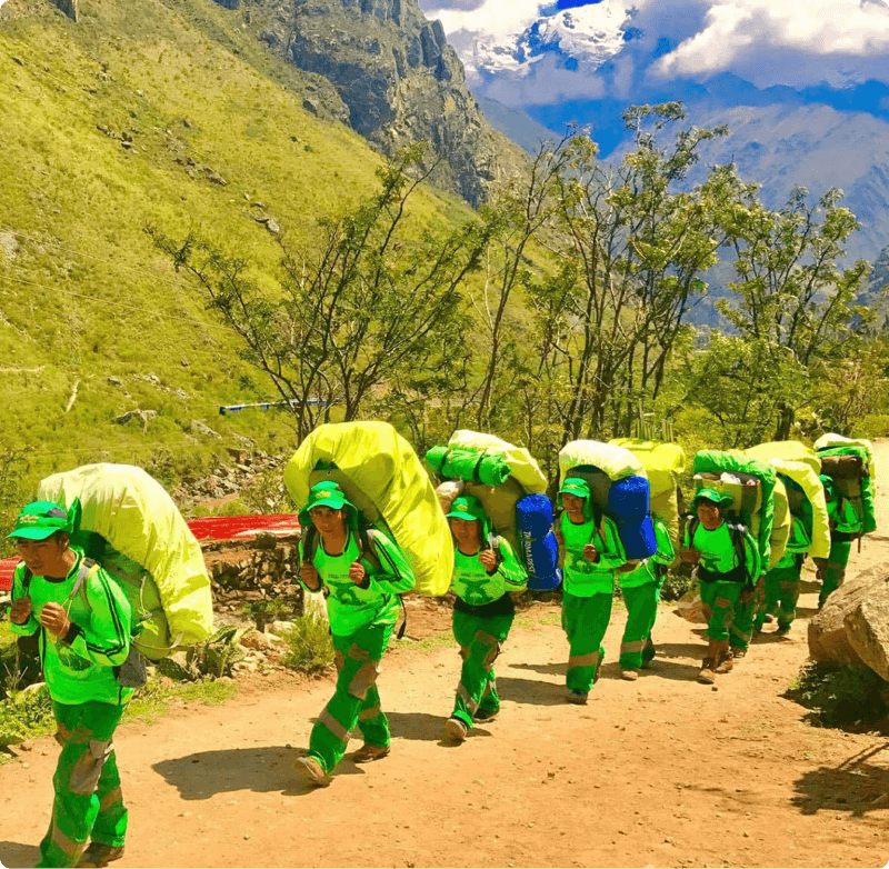 Porters will carry up to 7 kg of your personal items, which must include your sleeping bag and air mat (if you bring or rent one). From us, these two items weigh a combined total of 3.5 kg.