The Ultimate Peru Travel Guide 2025: Top Places to Visit, Must-See Destinations & Itineraries
Peru isn’t just a country; it’s a mosaic of ecosystems and civilizations. In one trip, you can stroll through colonial plazas built atop Inca foundations, wander among snow‑capped peaks, watch condors soar over one of the world’s deepest canyons, surf dunes at a desert oasis, share a meal with weaving cooperatives, and glide down Amazonian rivers listening to howler monkeys. This Peru Travel Guide 2025 will help you plan yourr perfect trip.
This guide is designed to help you plan a journey that stitches those experiences together in a way that feels effortless, authentic,c and mindful.
Using This Guide
You’ll find the major sights along with less obvious treasures, complete with historical context, practical tips, and sample itineraries. Because Peru’s geography is extremefrom sea level up to 5,000+ altitude acclimatization and logistics can make or break a trip. We’ve woven in altitude advice, sustainability notes, and safety guidance throughout. Think of this as a conversation with a well‑travelled friend who has researched so you don’t have to.
Seasons and Festivals
Peru’s climate is as varied as its topography. The Andean highlands have a dry season (May–September) with clear skies ideal for trekkingand a wet season (October–April) when afternoon showers turn trails muddy but landscapes lush. The coastal region is mild and foggy from June to November and warm and sunny from December to March.
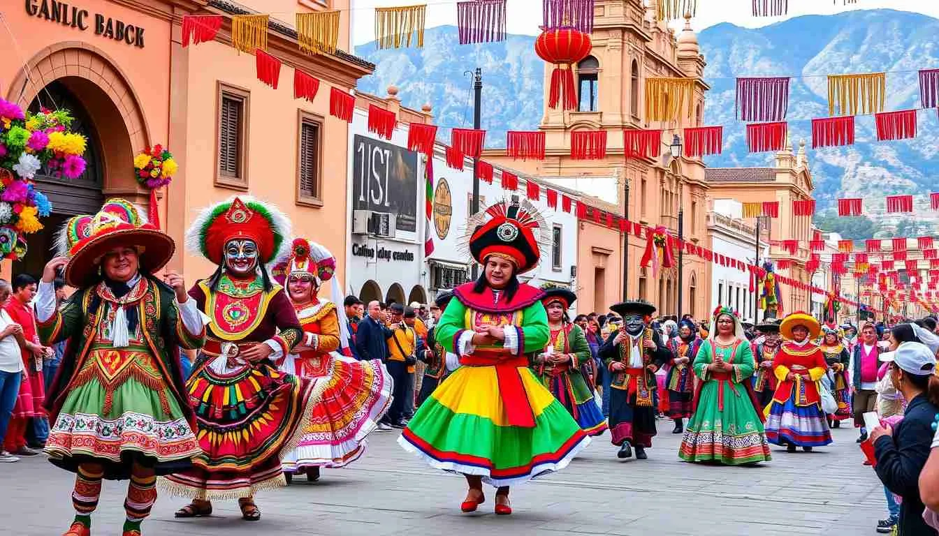
The Amazon sees heavy rains from December to March, though wildlife is abundant year‑round. Traveling during this period also allows visitors to enjoy the Benefits of Shoulder Season. Time your visit around festivals like Inti Raymi (24 June) in Cusco, the Virgin of the Candelaria in Puno (February), or Lima’s Peruvian Paso Horse shows if you want to witness cultural celebrations. High season runs June–August; book permits and accommodations well ahead.
Visas and Health Requirements
Citizens of the USA and UK currently receive a free tourist visa on arrival for stays up to 90 days. A passport validity of at least six months is required. Always confirm the current policy before departure, as immigration rules can change. Visit a travel clinic 6–8 weeks before your trip to discuss vaccinations; hepatitis A and typhoid are commonly recommended, and yellow fever vaccination is mandatory for travel to the Amazon. Carry proof of insurance covering medical evacuation.
Altitude Acclimatization
About half of Peru’s bucket‑list destinations sit above 3,000 m. At this elevation, oxygen levels drop, and the body needs time to adapt. The Centers for Disease Control recommend ascending no more than 500 m per day once above 3,000 m and spending at least two nights at intermediate altitudes.
Symptoms of acute mountain sickness include headache, nausea, fatigue and insomnia. To prevent them, hydrate constantly, avoid alcohol, eat light meals and consider medications like acetazolamide after consulting a doctor. Schedule your itinerary to climb graduallyspending a couple of nights in the Sacred Valley before tackling the high Inca Trail is a smart move.
Ethical Travel & Sustainability
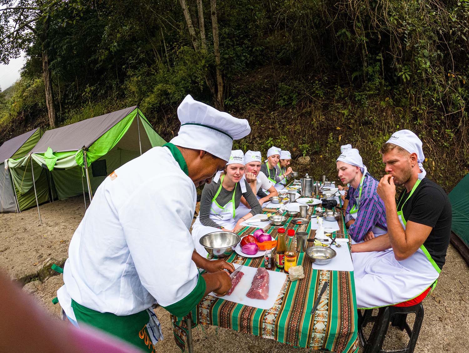
Tourism brings economic opportunities but also challenges. Choose tour operators that treat porters and guides fairlyensuring they carry legal weight limits, receive proper equipment and wages, and have adequate insurance. Avoid single‑use plastics, refill water bottles at hotels and lodges, and carry out any trash.
Support community enterprises by buying directly from artisans. Stay on marked trails to protect archaeological sites and fragile ecosystems. Being mindful of your impact enhances your experience and helps preserve Peru for future travelers.
Packing for Peru
Your packing list depends on your route, but layering is essential. Days in the Andes can be warm under the sun yet cold in the shade; nights drop below freezing at high altitude. Bring a down jacket, fleece, rain shell, quick‑dry shirts, hiking pants, a sun hat, and gloves. Comfortable walking shoes and hiking boots are critical.
For the Amazon, pack lightweight long‑sleeved shirts, long pants, a wide‑brimmed hat, insect repellent with DEET, and waterproof shoes. Other essentials include sunscreen, reusable water bottle, headlamp, adapter plugs, copies of important documents, and cash in small denominations. A detailed printable checklist is provided in the ancillary assets.
Deep Dive Into Peru’s Regions and Highlights
Machu Picchu & the Inca Trail
Perched at 2,430 m on a ridge surrounded by verdant peaks, Machu Picchu is the most famous surviving city of the Inca Empire. Built around 1450 as a royal estate for Emperor Pachacuti, it was abandoned after the Spanish conquest and remained hidden from outsiders until the early 20th century. Its precise stonework, agricultural terraces, and astronomical alignments reveal the Inca mastery of engineering and spirituality. The setting where cloud forest meets the high Andes adds to its mystique.
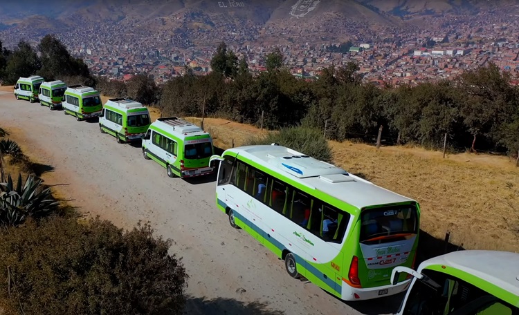
Getting there requires foresight. The classic Inca Trail is a four‑day trek passing smaller ruins like Llactapata and Winay Wayna before arriving at the Sun Gate at sunrise. Permits are limited to 500 people per day (including staff) and sell out months in advance. If permits are gone, consider alternative treks like Salkantay (snow‑capped passes and coffee farms), Lares (weaving villages and hot springs), or the one‑day KM 104 trek. Non‑hikers can take the train from Ollantaytambo or Poroy to Aguas Calientes and then bus up to Machu Picchu.
On-site, plan at least four hours. Begin at the Guardhouse for the postcard view, then explore the Temple of the Sun, the Main Plaza, the Sacred Rock, and clusters of agricultural terraces. If you’ve secured extra permits, hike Huayna Picchu (steep, 2 hours round‑trip) or Machu Picchu Mountain (longer, less crowded). Rules prohibit food, tripods, and drones; restrooms are outside the entrance.
Guided tours deepen understanding of the site’s astronomical and agricultural designguides interpret features like the Intihuatana stone (thought to be a solar clock) and the water channels. Remember to be respectful: stay on marked paths and avoid touching walls.
Cusco: Capital of the Incas and Gateway to the Andes
Cusco (also written Cuzco), at about 3,400 m, seamlessly blends Inca and Spanish colonial heritage. It was once the heart of the Tahuantinsuyo (Inca Empire) and later became a key city for Spanish colonists. The Plaza de Armas is lined with arcaded colonial buildings and dominated by the Cathedral, built on the foundations of Inca Viracocha’s palace.
Nearby is Qorikancha, the Temple of the Sun, whose perfect stone walls survive beneath the Church of Santo Domingo. Wander the cobbled lanes of the San Blas neighborhood, known for its artisans and steep alleys, and climb to Sacsayhuamán on a hill above the city. This massive fortress showcases cyclopean stone blocks fitted together without mortar; the largest weigh over 100 tons.
Cusco is also a culinary hub with dishes like alpaca steak, lomo saltado (stir‑fried beef and vegetables) and chicha morada (purple corn drink). The San Pedro Market is a sensory feast, offering local produce, cheeses, and herbs. Acclimatize in Cusco for two days before trekking; rest often, drink coca tea, and avoid overexertion. The climate is generally dry, with high sunshine and cold nights. Even in June and July, frost is rare, but bring warm clothing nonetheless.
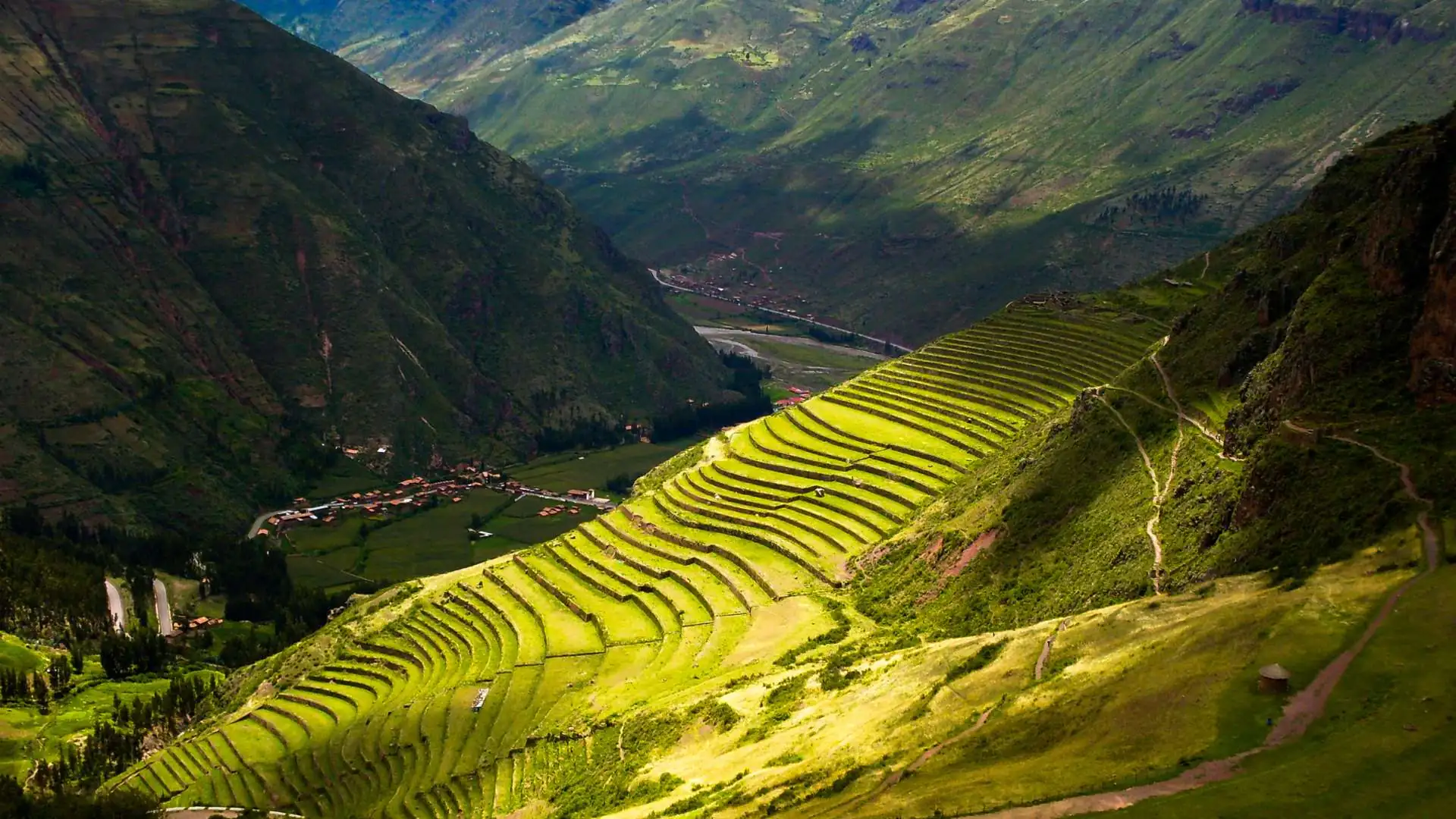
Sacred Valley: Heartland of Inca Agriculture and Estate
Just outside Cusco, the Sacred Valley unfolds as a fertile corridor carved by the Urubamba River. Its lower altituderanging from 3,000 m at Pisac to 2,050 m near Machu Picchumakes it an ideal place to acclimate. The valley floor is dotted with villages, terraced hillsides, and archaeological sites. Due to the favorable micro‑climate and soil, the Incas grew maize here and engineered complex irrigation systems. Today, the valley remains a patchwork of farms and Inca ruins.
Pisac
Pisac’s mountaintop ruins combine sweeping agricultural terraces with religious and military structures. Emperor Pachacuti likely built the complex around 1440 to secure the southern entrance to the valley and to support his panaca (royal household). The Inti Watana temple sits at the peak, offering panoramic views. Below, the village hosts a market every day (Sunday is busiest) where artisans sell textiles, ceramics, and silver jewelry. Visit the oven‑fresh empanada stalls near the market entrance.
Ollantaytambo
Fifty minutes beyond Pisac lies Ollantaytambo, an Inca town and fortress at 2,792 m. Its steep terraces ascend the mountainside; at the top, the Temple of the Sun features six immense monoliths. During the Spanish conquest, Manco Inca used this stronghold to fend off Hernando Pizarro’s troops. Wander the narrow cobblestone alleys with water channels still. This is one of the few places where Inca urban planning remains intact. Many travelers spend the night here to catch early trains or start the Inca Trail.
Chinchero
Higher up at 3,780 m, Chinchero is sometimes called the “rainbow town.” It contains 41 hectares of agricultural terraces and a 17th‑century church built on the foundations of Tupac Yupanqui’s palace.
Local women demonstrate backstrap loom weaving, using natural dyes from plants and insects. Purchasing textiles directly from cooperatives supports the community. Climate here has a dry season (May–Nov) and rainy season (Nov–May) with daytime temperatures between 8 °C and 20 °C.
Maras & Moray
A short drive from Chinchero, the town of Maras sits at 3,300 m and is famed for its terraced salt ponds. More than 5,000 pans cascade down a hillside; families harvest salt by evaporating mineral‑rich spring water. Nearby Moray features concentric circular depressions, the largest about 30 m deep.
Temperature differences of up to 15 °C between the top and bottom created micro‑climates, suggesting the Incas experimented with crops. Today, you can walk along the terraces (stay on designated paths) and imagine ancient agronomists at work.
Additional Valley Stops
The Sacred Valley is dotted with other gems: Urubamba (a mellow town with adventure lodges), Yucay (historic haciendas), Salineras Trek to the salt pans, and Huchuy Qosqo, an Inca site accessible by a day hike from Chinchero. All told, set aside at least three full days to explore the valley; more if you want to cycle, raft or ride horses.
Lima: Peru’s Coastal Metropolis
Peru’s capital gets mixed reviews: some travelers fly straight out, while others fall in love with its coastal bluffs, colonial squares and booming food scene. Either way, a couple of days in Lima enriches any itinerary.
Historic Centre
Lima’s Historic Centre is the colonial core established by Francisco Pizarro on 18 January 1535. It became the political, religious, and economic capital of the Viceroyalty of Peru. Its grid of streets and balconied mansions remains largely intact, earning UNESCO World Heritage status.
Start at Plaza Mayor, flanked by the Cathedral, Government Palace, and Archbishop’s Palace. Nearby, the Monastery of San Francisco impresses with its cloisters and catacombs. Many buildings were constructed by artisans from Spain and have survived numerous earthquakes. Visit in the morning to avoid crowds and midday heat.
Miraflores
Miraflores sits on cliffs overlooking the Pacific Ocean and is Lima’s upscale hub. The Malecón is a series of parks along the cliff where joggers and cyclists follow its paths, lovers pose at the mosaic‑covered Parque del Amor, and paragliders launch into the sea breeze. Kennedy Park anchors the district with cafes, craft markets and friendly cats.
According to local guides, Miraflores is the most popular base for travelers seeking lodging, shopping and nightlife. It offers everything from high‑end restaurants to surf lessons at Waikiki beach. Stay vigilant when crossing busy streets and watch for pickpockets in crowded areas.
Barranco
South of Miraflores is Barranco, Lima’s bohemian quarter. In the 19th century, it was a fashionable beach resort for Lima’s aristocracy; today it houses many artists, musicians, and designers. Barranco’s beaches remain popular with surfers, and a modern marina caters to yachts.
down the Bajada de los Baños, a walkway leading from the plaza to the beach; cross the Bridge of Sighs and make a wish; and visit the Pedro de Osma Museum for a superb collection of colonial art. Barranco’s micro‑climate is warmer and drier than much of Lima, thanks to cliffs that shield it from humid southern winds. Enjoy street art, craft beer bars and live music venues; evenings are lively but generally safe.
Arequipa & Colca Canyon: Volcanic Stone and Deep Valleys
Framed by three volcanoesMisti, Pichu Pichu, and ChachaniArequipa earns its nickname “The White City” from its buildings made of pale volcanic sillar. Its historic centre combines European baroque and indigenous design; wander through the Santa Catalina Monastery, a city within a city with brightly painted lanes and cloistered cells. Climb the bell tower of Iglesia de la Compañía for sweeping views.
At the Juanita Museum, learn about an Inca girl sacrificed on Mount Ampato whose frozen body was discovered in 1995. Arequipa sits around 2,328 m with sections as low as 2,041 m and as high as 2,810 m. The climate is dry and sunny most of the year, with temperatures rarely exceeding 25 °C or dropping below 5 °C.
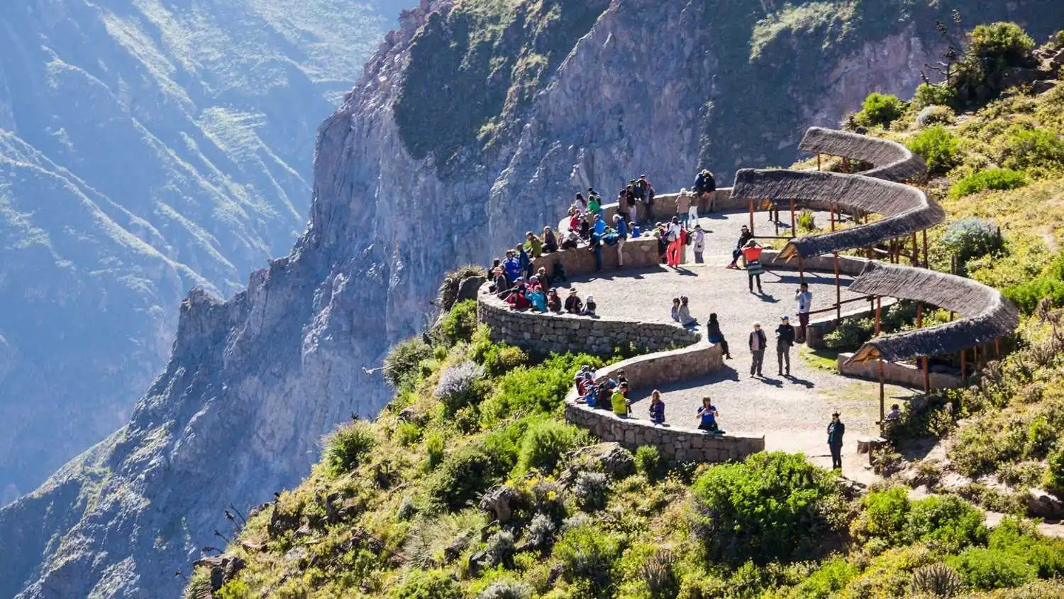
Ninety miles northwest lies Colca Canyon, a gorge roughly twice the depth of the Grand Canyon at about 4,160 m. The canyon is carved by the Rio Colca and lined with pre‑Inca agricultural terraces still in use today. Village life revolves around the seasons; locals grow quinoa, corn, and potatoes, and still wear traditional clothing.
The highlight for many visitors is Cruz del Condor, a lookout where Andean condors rise on morning thermals. Tours range from day trips to challenging three‑day treks. If you trek, anticipate steep descents on dusty trails and a strenuous climb on the return; start early to avoid midday heat and always carry sufficient water.
Acclimate in Arequipa for at least one day before visiting; the canyon sits around 3,600 m. Entrance fees and optional guide services support conservation and local communities.
Lake Titicaca: Cradle of the Sun
At 3,810 m above sea level, Lake Titicaca is the world’s highest navigable lake and covers about 8,300 km². According to Andean legend, it is the birthplace of the sun god and of Manco Cápac and Mama Ocllo, founders of the Inca dynasty. The lake’s altitude means thin air and chilly nights, yet its deep waters moderate temperatures, creating a micro‑climate that supports agriculture.
From the port city of Puno, boat tours depart daily. The Uros people live on floating islands woven from totora reeds; visiting offers insight into their engineering and resilience, but choose operators who prioritize community benefits and avoid staged interactions.
Farther out, Taquile Island is known for its fine textiles knit intricate hats while women weave belts. A homestay on Amantani Island introduces you to Quechua family life; expect simple rooms, cold showers and hearty home‑cooked quinoa soup. At the shore, explore Sillustani, a pre‑Inca necropolis with towering chullpa tombs on a peninsula in Lake Umayo. Pace yourself: walking at 3,800 m is slow; drink plenty of water and limit alcohol.
Southern Coast: Desert, Geoglyphs and Marine Sanctuaries
Heading south from Lima, the Pan‑American Highway skirts an arid expanse punctuated by cultural and natural wonders.
Nazca Lines
The Nazca Lines are among archaeology’s greatest enigmas. Stretching across 450 km² of desert, hundreds of huge geoglyphs depict animals (condor, monkey, hummingbird), plants, and geometric shapes. Scholars debate whether they served astronomical, ritual or calendrical purposes.
Most lines are best appreciated from the air; 30‑minute flights depart from Nazca and Pisco airports. Turbulence can be rough, so bring motion sickness medication. On the ground, visit the Maria Reiche Museum in town to learn about the German mathematician who dedicated her life to preserving the lines. Use sun protection and carry watertemperatures soar and shade is scarce.
Paracas National Reserve & Ballestas Islands
A couple of hours south of Lima, Paracas National Reserve protects 3,350 km² of desert and sea, including nesting grounds for 216 bird species and marine mammals like sea lions and whales. Kayak across tranquil bays, picnic at Playa La Mina, and hike along ochre cliffs.
The adjacent Ballestas Islands, accessible by two‑hour boat trips, harbor Humboldt penguins, guanay and red‑legged cormorants, Peruvian boobies, and sea lions. En route you’ll see El Candelabro, a massive geoglyph carved into a hillside. Tours depart early morning when waters are calmest; wear a jacket, as sea spray and wind can be brisk. Stay in the town of Paracas for a relaxed seaside vibe.
Huacachina Oasis
A surreal stop near Ica, Huacachina is built around a palm‑lined lagoon encircled by dunes up to 500 m high. Legend says a princess created the lagoon when she dropped her mirror; the dunes are said to be folds of her mantle.
Today the oasis draws backpackers and families for dune buggy rides and sandboarding. Climb the dunes at sunrise or sunset for sweeping views, but avoid midday when the sand is scorching. The lagoon’s water is no longer naturally replenished and is pumped in, so swimming is discouraged. Stay overnight to enjoy the desert light and live music at bars.
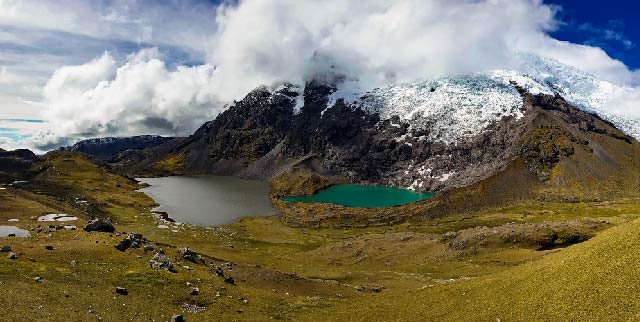
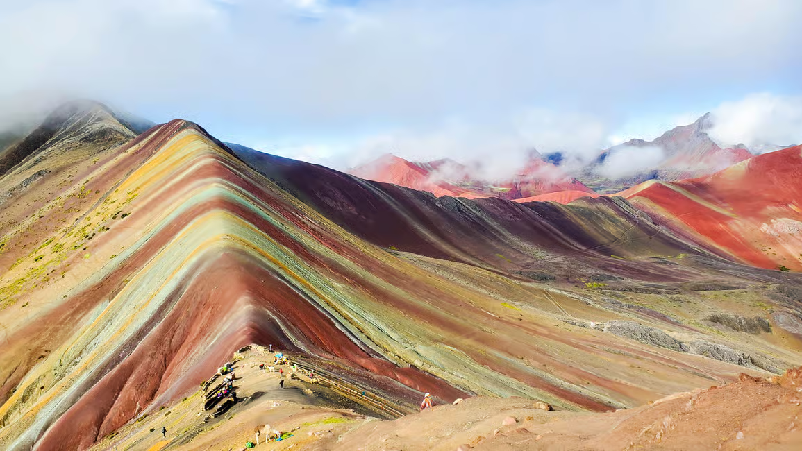
Rainbow Mountain & the Ausangate Region
Not long ago, Rainbow Mountain was hidden under ice. At around 5,200 m, Vinicunca’s layers of red, gold, and turquoise minerals were revealed when snow melted around 2013. The mountain’s colors come from 14 distinct minerals, including iron oxide and copper. From Cusco, a 3‑hour drive leads to the trailhead at about 4,500 m. The out‑and‑back hike is roughly 7 km, climbing to a panoramic ridge across from the mountain.
Due to the elevation, even fit hikers may feel breathless; acclimate for several days and consider hiring a horse for part of the climb. The weather is unpredictable; hail and sunshine can alternate in minutes. Pack layers, a hat, and rain gear. Entrance fees are small and go toward local communities and trail maintenance. Respect the fragile soils by staying on the main path.
Amazon Rainforest: Lungs of the Earth
Peru’s share of the Amazon is one of the most biodiverse regions on the planet. Whether you choose the bustling river port of Iquitos or the more accessible Tambopata near Puerto Maldonado, the jungle immerses you in a world of giant ceiba trees, pink river dolphins and macaw‑filled clay licks.
Iquitos and the Northern Amazon
Iquitos is the largest city in the Peruvian Amazon and is unique in that it cannot be reached by road; access is only by river or air. Situated at the confluence of the Amazon, Nanay, and Itaya rivers, it buzzes with motorized rickshaws and floating markets. Visitors tour Belén, a neighborhood of houses on stilts, shop at the Mercado de los Brujos (witch market) for herbal remedies, or embark on multi‑day cruises deep into the primary forest.
Excursions include visits to wildlife rehabilitation centres, paddling oxbow lakes to spot sloths and monkeys, and night walks to see tarantulas and phosphorescent fungi. Expect humidity over 90 % and temperatures around 30 °C year‑round. Mosquitoes are relentless; wear long sleeves and apply repellent regularly.
Tambopata National Reserve & Puerto Maldonado
Further south, Tambopata National Reserve spans 274,690 ha and protects lowland forest, bamboo stands and meandering rivers. Scientists have recorded 1,713 plant species, as well as 632 bird species, 120 reptiles and amphibians, and dozens of large mammals, including jaguar, puma, tapir, and giant otter.
One of the reserve’s highlights is the clay lick on the río Tambopata, where hundreds of scarlet, red‑and‑green, and blue‑and‑yellow macaws gather at dawn to eat mineral‑rich clay. Lodges offer canopy towers rising above the treetops, night walks to observe nocturnal insects and mammals, and boat safaris where caimans glide like logs.
Access is by boat from Puerto Maldonado; flights connect the town with Lima and Cusco. Because this region is low‑lying (200–400 m), altitude isn’t an issue, but insects and heat are. Follow your guide’s instructions to avoid disturbing wildlife and never feed animals.
Northern Peru: Ancient Civilizations and Mountain Landscapes
While the southern circuit grabs most attention, northern Peru rewards those who venture off the standard route. Here you’ll find formidable ruins predating the Incas, towering waterfalls and pristine beaches.
Huaraz & Cordillera Blanca
Three hundred miles north of Lima, Huaraz sits at 3,052 m in the Callejón de Huaylas, a valley framed by the Cordillera Blanca highest tropical mountain range in the world. Huascarán, Peru’s tallest peak, soars to 6,768 m in the Huascarán National Park. Day hikes such as Laguna 69 lead to cobalt blue glacial lakes; multi‑day treks like the Santa Cruz circuit cross alpine passes with sweeping views.
Seasonally, the best trekking weather is May–September when skies are clear. Take rest days in Huaraz to acclimate; altitude here is similar to Cusco. The town itself is utilitarian but offers hearty mountain cuisine like pachamanca (meat and potatoes baked underground) and serves as a base for rock climbing and mountain biking.
Kuelap & Chachapoyas
Deep in the cloud forests of the Amazonas region, Kuelap was built by the Chachapoya people around the same time as Machu Picchu. Often called the “Machu Picchu of the North,” it sits atop a ridge at 3,000 m and is encircled by walls up to 20 m high. Inside lie hundreds of round stone houses once thatched with palm roofs.
A modern cable car from the town of Tingo makes access easier; allow a day for travel and exploration. Nearby, the colonial town of Chachapoyas is the jumping‑off point for the two‑tiered Gocta Waterfall, one of the tallest in the world at 771 m. Trails wind through dense forest alive with hummingbirds.
Chan Chan & Trujillo
On the northern coast near Trujillo, Chan Chan was the capital of the Chimú civilization and is the largest adobe city on earth. Its labyrinthine palaces feature intricate friezes of fish, birds and geometric patterns. Hire a guide to appreciate the site’s sophisticated irrigation and social organization.

Combine your visit with the Huacas del Sol y de la Luna, pyramidal temples built by the Moche culture with vivid murals, and the seaside village of Huanchaco, famous for reed fishing boats called caballitos de totora and consistent surfing waves.
Mancora & Northern Beaches
If your body craves warmth and relaxation after high‑altitude adventures, head to Mancora. This laidback beach town boasts year‑round sunshine, warm waters and a lively nightlife. Surf schools line the beach, and there are opportunities to kite‑surf, snorkel with turtles in nearby Organos or watch humpback whales (July–October).
Accommodation ranges from backpacker hostels to boutique eco‑lodges. Other beaches like Punta Sal, Vichayito and Los Órganos offer quieter escapes. Reach Mancora via a short flight to Tumbes or Piura plus a bus or taxi.
Additional Hidden Gems
- Caral – North of Lima, this UNESCO site dates back to around 2600 BC and is considered the oldest city in the Americas. Its pyramids predate the Inca by two millennia.
- Sillustani – Near Puno, cylindrical funerary towers called chullpas rise on a peninsula in Lake Umayo. They belonged to the Qulla people, pre‑dating the Incas, and offer atmospheric sunset views.
- Cajamarca – A highland town where the last Inca emperor Atahualpa was captured by Francisco Pizarro. Colonial churches, hot springs and nearby Cumbe Mayo aqueducts make it worth a detour.
- Manu National Park – One of the most biodiverse areas on Earth. Access is restricted; specialized tours combine days of rafting, boating and walking to reach remote lodges. Permits are required well in advance.
Conclusion
Peru invites exploration on many levels. You can chase sunrise on ancient citadels, sample 2,000 varieties of potatoes, converse with artisans weaving centuries‑old patterns, or listen to the jungle chorus from a riverboat. There is no single “best” itineraryonly the one that suits your interests, time and energy.
Start with the sample routes provided here and adapt them. Take time to acclimate, travel responsibly and remain curious. When you’re ready to experience the Andes on foot or connect with indigenous communities, consider local specialists like Alpaca Expeditions to guide you; their deep knowledge and commitment to ethical travel will enrich your journey.
Ancillary Assets
Destination Comparison Table
| Destination | Altitude (m) | Highlights | Recommended Stay | Best Season |
| Machu Picchu | 2,430 | Inca citadel, Huayna Picchu climb, Temple of the Sun | 1–2 days | May–October |
| Cusco | ~3,400 | Plaza de Armas, Sacsayhuamán, Qorikancha, San Blas | 2–3 days | Year‑round (dry May–Sept) |
| Sacred Valley | 2,050–3,800 | Pisac ruins & market, Ollantaytambo fortress, Maras salt pans, Moray terraces | 3–4 days | May–September |
| Lima | 13–123 (sea level) | Historic Centre, Miraflores cliffs, Barranco art scene | 2 days | December–April for sun |
| Arequipa | 2,041–2,810 | White sillar architecture, Santa Catalina Monastery, volcano views | 2–3 days | April–December |
| Colca Canyon | 3,600 | Condor lookout, terraced villages, trekking | 1–3 days | April–November |
| Lake Titicaca | 3,810 | Uros floating islands, Taquile & Amantani, Sillustani | 2–3 days | May–October |
| Nazca | 520 | Geoglyph flights, Chauchilla cemetery | 1–2 days | May–October |
| Paracas & Ballestas | 0–50 | Marine wildlife, El Candelabro geoglyph, desert reserve | 1–2 days | December–April |
| Huacachina | 400 | Sandboarding, dune buggies, sunset over dunes | 1–2 days | Year‑round (avoid midday heat) |
| Rainbow Mountain | 5,200 | Multicolored strata, Ausangate views | 1 day | Dry season (May–September) |
| Iquitos | 104 (river level) | River cruises, Belén market, Pacaya‑Samiria Reserve | 3–4 days | June–October |
| Tambopata | 200–400 | Clay licks, canopy towers, night safaris | 3–4 days | May–October |
| Huaraz | 3,052 | Trekking (Laguna 69, Santa Cruz), Huascarán NP | 3–5 days | May–September |
| Kuelap | 3,000 | Chachapoya fortress, cable car ride | 1–2 days | May–October |
| Chan Chan | 34 | Adobe city ruins, Moche temples nearby | 1–2 days | May–December |
| Mancora | Sea level | Surfing, warm beaches, whale watching | 2–4 days | December–April (for sun); July–Oct (for whales) |
Printable Packing List
Documents & Money
- Passport (valid for at least six months)
- Printed itineraries and permits (Machu Picchu, Inca Trail, etc.)
- Travel insurance details and emergency numbers
- Vaccination card (yellow fever certificate for Amazon)
- Copies of important documents stored separately
- Cash in small bills (soles), credit/debit cards
Clothing
- Moisture‑wicking t‑shirts (3–4)
- Long‑sleeved shirts for sun and insects (2–3)
- Warm layers: fleece or down jacket, sweaters
- Waterproof rain shell and pants
- Comfortable hiking pants and shorts
- Thermal base layers for cold nights
- Sleepwear
- Sun hat or cap and wool beanie
- Buff or scarf for dust and wind
- Gloves (especially for high altitude)
Footwear
- Sturdy hiking boots (broken in)
- Comfortable walking shoes or sneakers
- Sandals or flip‑flops (for showers/lodging)
- Trekking socks (wool or synthetic, 3–4 pairs)
Gear & Accessories
- Daypack (20–30 L) with rain cover
- Larger backpack or suitcase (50–70 L) for main luggage
- Trekking poles (collapsible)
- Reusable water bottle and water purification tablets/filter
- Headlamp or flashlight with extra batteries
- Sunglasses (UV protection)
- Travel towel
- Insect repellent (DEET or picaridin)
- Sunscreen (SPF 30+)
- Personal first‑aid kit (bandages, antiseptic, pain relievers, motion sickness meds)
- Prescription medications (in original packaging)
- Wet wipes and hand sanitizer
- Toiletries (biodegradable soap/shampoo, toothbrush, toothpaste)
- Camera or smartphone with chargers and power bank
- Plug adapter (Peru uses 220 V, types A and C plugs)
- Dry bags or zip‑lock bags for valuables
- Snacks (energy bars, nuts)
Optional
- Binoculars (for wildlife)
- Lightweight sleeping bag (if doing multi‑day treks; check if your tour provides one)
- Earplugs and eye mask (for buses and hostels)
- Notebook and pen
- Spanish phrasebook or downloaded translation app
Acclimatization Schedule Example
| Day | Altitude (m) | Activity | Tips |
| Day 1 | Sea level (Lima) | Arrive, rest, light sightseeing | Hydrate well, avoid alcohol |
| Day 2 | 3,400 (Cusco) | Flight to Cusco; gentle city tour | Walk slowly, drink coca tea |
| Day 3 | 2,800 (Sacred Valley) | Transfer to Pisac or Ollantaytambo; explore ruins | Lower altitude helps acclimation |
| Day 4 | 2,430 (Machu Picchu) | Visit Machu Picchu via train or short trek | Carry water and snacks |
| Day 5 | 3,400 (Cusco) | Return to Cusco; optional Sacsayhuamán visit | By now you should feel better |
| Day 6 | 5,200 (Rainbow Mountain) | Day trip; early start | Use altitude medication; hire a horse if needed |
| Day 7 | 2,328 (Arequipa) | Fly or bus to Arequipa | Lower altitude provides relief |
Sustainable Travel Checklist
- Choose tour operators that limit group sizes and adhere to porter welfare regulations.
- Bring reusable water bottles, cutlery and bags to reduce plastic waste.
- Do not feed or touch wildlife; observe from a distance.
- Stay on designated trails to prevent erosion and protect archaeological sites.
- Buy handicrafts directly from artisans rather than from large resellers.
- Learn basic greetings in Quechua and Spanish to show respect.
- Carry out all trash, including organic waste.
- Offset your carbon footprint by supporting reforestation or conservation projects in Peru.
FAQs
- What is the best month to visit Peru?
It depends on your itinerary. For trekking in the Andes and visiting Machu Picchu, May to September offers dry weather and clear skies. The Amazon is drier and less buggy June–October. The coastal summer runs December–March. - Do US and UK citizens need a visa to visit Peru?
As of this writing, citizens of the USA and UK can enter Peru visa‑free for tourism up to 90 days. Always check official sources before travel as regulations may change. - How many days do I need for Machu Picchu?
Allocate at least two days: one to reach Aguas Calientes and one for an early morning visit. If hiking the Inca Trail, plan four days. - Is altitude sickness common in Peru?
Yes. Many popular sites lie above 3,000 m. Acclimatize gradually, hydrate, avoid alcohol and consider medication. Seek medical help if symptoms worsen. - When should I book the Inca Trail?
Permits open in October for the following year and sell out quickly for peak months (May–August). Book at least six months ahead. - Can I visit Machu Picchu without hiking?
Yes. Take a train from Cusco or Ollantaytambo to Aguas Calientes and then a shuttle bus to the site. - What is the difference between Rainbow Mountain and Palcoyo?
Rainbow Mountain (Vinicunca) is steeper and more crowded; Palcoyo offers several colorful hills with an easier, shorter hike and fewer people. -
Is Peru safe for solo travelers?
Generally, yes. Exercise usual precautions: avoid isolated areas at night, use registered taxis, and keep valuables secure. Tourist areas have police presence.
- How do I get to the Amazon in Peru?
Fly to Iquitos for the northern Amazon or Puerto Maldonado for the southern Amazon. From there, travel by boat to jungle lodges or river cruises. - Do I need a yellow fever vaccine?
A yellow fever certificate is required for travel to Amazonian regions and may be required upon entry from jungle areas. Consult a travel clinic. - What languages are spoken in Peru?
Spanish is the official language. Quechua and Aymara are widely spoken in the Andes; many people in the tourism industry speak English. - How reliable are Peru’s buses and trains?
Long‑distance buses (Cruz del Sur, Oltursa) are modern and comfortable. The PeruRail and Inca Rail trains to Machu Picchu are reliable but book ahead. Delays can occur due to weather or strikes. - What currency is used in Peru?
The Peruvian Sol (S/). Carry small bills for markets and rural areas; credit cards are accepted in cities. - Is the tap water safe to drink?
No. Drink bottled or filtered water, and avoid ice outside reputable restaurants. - What should I wear in Peru?
Layering is key. Bring moisture‑wicking shirts, warm layers, a rain jacket, sun hat, and comfortable shoes. For the Amazon, pack lightweight long sleeves and pants. -
Can I visit Lake Titicaca from Cusco?
Yes. The bus takes about 7 hours; many travelers stop in Puno to acclimate before island tours. You can also take a scenic train or fly to Juliaca.
- Are credit cards widely accepted?
In major cities, yes. In small towns and markets, cash is essential. ATMs are widely available but may charge fees. - What is Peru’s food like?
Diverse and flavorful. Try ceviche on the coast, cuy (guinea pig) in the Andes, and juane (rice and chicken wrapped in leaves) in the Amazon. Lima is a gastronomic capital with world‑class restaurants. - Is tipping expected in Peru?
Tipping is appreciated though not mandatory. In restaurants, 10 % is customary. Tip guides and porters based on service and weight carried. - Can I travel independently or should I join a tour?
Peru is traveler‑friendly; many sites can be visited independently. However, tours simplify logistics for remote areas (Amazon, Inca Trail) and provide local insights. -
Are drones allowed at tourist sites?
Drones are prohibited at Machu Picchu and many archaeological sites. Special permits are required elsewhere. Check regulations before packing a drone.
- What electrical outlets are used in Peru?
Peru uses 220 V with type A (flat) and type C (round) plugs. Bring an adapter and possibly a voltage converter for sensitive devices. - How do I stay connected?
Buy a local SIM card (Claro, Movistar) or use e‑SIM services. Wi‑Fi is available in hotels and cafes in major cities. Remote areas may have limited signal. - What is the best way to exchange money?
ATMs offer the best rates; avoid exchanging cash at airports where rates are poor. In cities, authorized money changers are reliable. - Are there any cultural taboos?
Avoid pointing at people, ask permission before photographing, and don’t refer to locals as “Indians.” Dress modestly when visiting churches and indigenous communities. -
What footwear do I need for Rainbow Mountain?
Sturdy hiking boots with good grip. The trail can be muddy or snowy; waterproof boots are ideal.
- How long does it take to adjust to high altitude?
Most people need 2–3 days to adapt to elevations around 3,000–3,500 m. Complete acclimatization takes a week or more. Listen to your body. - Can I combine Peru with Bolivia or Ecuador?
Yes. Overland routes connect Puno with La Paz across Lake Titicaca, and northern Peru links to Ecuador’s beaches and the Galápagos. Check visa requirements and border regulations. - Is travel insurance necessary?
Strongly recommended. Policies should cover trip cancellation, medical expenses, evacuation and adventure activities (trekking above 3,000 m). - What wildlife can I see in Tambopata?
Tambopata hosts jaguars, pumas, tapirs, giant otters, capybaras, macaws, monkeys and hundreds of bird species. Wildlife sightings aren’t guaranteed, but early morning and evening excursions increase your chances. - Is it worth visiting the Nazca Lines if I’m afraid of flying?
Seeing the lines from a plane offers the best perspective, but observation towers provide partial views. Consider combining a short flight with visits to regional museums to appreciate their significance. -
How cold does it get on the Inca Trail?
Temperatures can drop below freezing at night, especially at Dead Woman’s Pass (~4,215 m). Bring warm sleeping gear and layered clothing.
- Do I need trekking permits outside the Inca Trail?
Many alternative treks do not require permits, but local entrance fees and registered guides may be necessary. Check with tour operators. - What is the food like on multi‑day treks?
Reputable outfitters provide hearty meals featuring soups, grilled meats, quinoa, pasta and plenty of tea. Dietary requirements can often be accommodated with advance notice. - Are there vegetarian or vegan options in Peru?
Yes. Major cities and tourist hubs offer vegetarian and vegan restaurants. On treks, inform your outfitter ahead of time. Staples like potatoes, corn, beans and vegetables make plant‑based eating feasible. - Can I rent gear in Peru?
Yes. Cities like Cusco and Huaraz rent sleeping bags, trekking poles and jackets. Quality varies; bring gear from home if you require specific brands. - What cultural etiquette should I know in Andean villages?
Greet with a smile and handshake, address elders first, and accept offered food or drink graciously. Avoid entering homes uninvited and respect local customs (e.g., asking before taking photos). - How can I support local communities?
Buy crafts directly from artisans, stay in community‑run lodges, hire local guides and donate to reputable social enterprises. Participate in cultural demonstrations respectfully and tip fairly. - Is Wi‑Fi available on the Inca Trail?
No. Enjoy being disconnected; focus on the trail and your surroundings. Mobile signal is non‑existent on most treks.
What happens if there is a strike or protest?
Demonstrations sometimes disrupt transportation. Stay informed through local news and your tour operator. If roads or sites close, adjust your itinerary and remain flexible.
Alpaca Expeditions Recognitions
ISO (International Organization for Standardization)
In the pursuit to stand out from the rest, Alpaca Expeditions has obtained four ISOs plus our carbon footprint certificate to date. These achievements result from our efforts to implement the internationally-recognized integrated management system. They also represent our commitment to all of our clients and staff of operating sustainability and responsibility in every way possible.


World Travel Awards
Alpaca Expeditions is internationally recognized as a leading tourism company in Peru. As proof, we have been awarded the World Travel Award for Peru´s Best Tour Operator 2021 for the second time.


TRIPADVISOR RECOGNITIONS
Our goal at Alpaca Expeditions is to create the best experience for all of our clients. We create journeys that are to be remembered for a lifetime. Journeys you can be proud of and can share with everybody around you.


As Featured In


Scan Here!


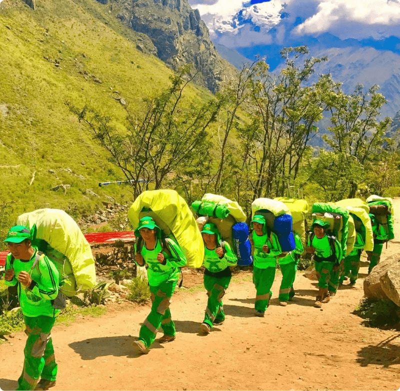 Porters will carry up to 7 kg of your personal items, which must include your sleeping bag and air mat (if you bring or rent one). From us, these two items weigh a combined total of 3.5 kg.